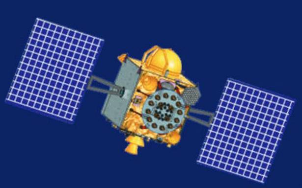
The International Maritime Organization (IMO) has recognised the Indian Regional Navigation Satellite System (IRNSS) as a component of the World-Wide Radio Navigation System (WWRNS) for operation in the Indian Ocean Region.
IRNSS is an independent regional navigation satellite system developed by India to provide accurate position information service to assist in the navigation of ships in Indian Ocean waters.
Low home loan rates, government thrust on affordable housing and projects at prime locations make the company’s prospects bright
The average cost of a data breach in healthcare is $7.3 million, according to IBM’s report
Low home loan rates, government thrust on affordable housing and projects at prime locations make the company’s prospects bright
The Directorate General of Shipping (DGS) initiated the matter with the IMO for grant of recognition to IRNSS as a component of the World-Wide Radio Navigation System (similar to GPS and GLONASS). Details of the tests carried out on merchant ships concerning the accuracy of the system was included in the report prepared by Indian Space Research Organisation (ISRO) which was submitted to IMO for consideration.
After detailed analysis, the sub-committee on Navigation, Communications and Search and Rescue recommended to the Maritime Safety Committee of IMO for accepting the IRNSS as a component of the World-Wide Radio Navigation System.
The Maritime Safety Committee of IMO during its recent meeting held from 4 to 11 November approved the recognition of IRNSS as a component of the World-wide radio navigation system, a government statement said.
This will enable merchant vessels to use IRNSS for obtaining position information similar to GPS and GLONASS to assist in the navigation of ships in ocean waters within the area covered by 50°N latitude, 55°E longitude, 5°S latitude and 110°E longitude (approximate up to 1,500 km from Indian boundary).
Source: Business Hindu Line