Shipowners and operators are increasingly incorporating fleet management tools into their operations as they seek to maximize efficiencies, both in the home office and on their ships. As they grow more comfortable with the benefits of the technology, they are looking for more sophisticated solutions.
Having started with core applications such as voyage planning, as the new generations of ships become more digitally connected, managers are realizing the additional benefits of nautical information management. The systems are helping to improve safety, reduce cargo damage, and enhance schedule predictability. The new generation of applications and the data they generate is delivering numerous benefits, ranging from lower fuel costs to improved data management and an overall reduction in operating expenditure.
Fleet Management Software Solutions
A decade after the launch of the first-ever FleetManager, C-MAP, a provider of commercial marine charting and cloud-based software solutions for fleet management and route optimization, has launched the fourth generation of its application providing managers its most advanced web-based fleet management solution to date.
“FleetManager 4.0 is the largest and most impressive update to our FleetManager solution yet and marks two years’ worth of development and dedicated work from our experts to produce the most powerful fleet intelligence and management solution ever delivered to the market,” said Niles Baker, Global Sales Lead of Fleet Products and Services. “With improved integration, more real-time data, and a lightning-fast interface, it ensures shoreside managers can continue to get the insights and make decisions whenever they want, where they want, and all in one place.”
The new version incorporates an all-new, faster HTML5-based web interface with a modern look and feel while retaining the workflow and features of the proven system. It also incorporates full integration of Microsoft Power BI business intelligence and analytics dashboards, allowing users to see a graphical representation of all their ship’s data in real-time and offering increased visibility and transparency into the performance of their fleet. It is also compatible with all modern internet browsers, including Chrome, Firefox, and Edge.
While providing enhancements to the interface and adding new functionality, the system also incorporates all the existing FleetManager features, including an extensive library of pre-built reports covering vessel performance, efficiency, and government-mandated reports. It also offers proactive, real-time alerts for underperformance and schedule deviations, along with data validation.
Among the new features added to FleetManager are tools that provide visibility and comparison of C-MAP Routing Service’s recommended route(s) against the Master’s intended route(s). In addition, seventeen new types of weather forecast data can be overlaid on the display. Available weather layers now include sea surface temperature, fog/visibility, precipitation, and ice, in addition to layers such as wind speed, wave height, surface pressure, and tropical storm tracks that were available previously.
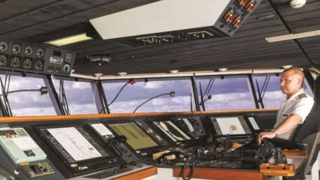
Bridge Planning Station
Concurrent with the introduction of the new FleetManager program, C-MAP also announced a new service and improvements to its C-MAP IMS™ advanced back-of-bridge planning station. The system, which integrates with the fleet management tools, supports a modern and efficient workflow for automated chart and publication management, and a comprehensive set of simple-to-use but powerful tools for route planning, graphical and quantitative analysis of weather and navigational data.
C-MAP is adding NAVAREA Warnings as one of many new features and improvements that are available with the IMS 2.2.2 release. The NAVAREA Warnings Service delivers a convenient, automated, and continually updated data set fully integrating with the crew’s existing voyage planning and weather routing workflow. The global coverage incorporates NAVAREA and sub-area warnings as well as coastal warnings for primary shipping areas including the Baltic, UK, Pakistan, Brazil, Australia, Argentina, South Africa, India, Japan, New Zealand, and Norway. Additional regions are available on request .
Source: Maritime-executive