A powerful 7.3-magnitude earthquake struck off the coast of Alaska on Wednesday, triggering a tsunami warning for parts of the region, according to the US Geological Survey (USGS).
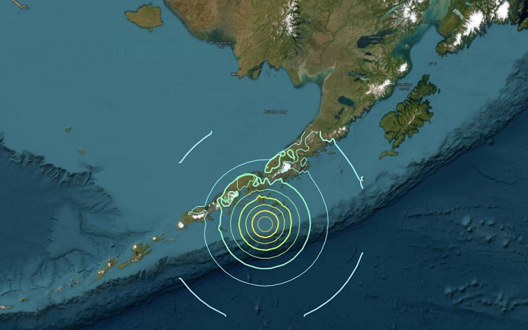
The quake hit at approximately 12:37 PM local time (2037 GMT), with its epicenter located about 54 miles (87 km) south of Sand Point, near Popof Island in the central part of the Alaska Peninsula. The earthquake originated at a depth of 20.1 kilometers, categorizing it as relatively shallow—typically increasing the potential for surface-level damage.
The National Oceanic and Atmospheric Administration (NOAA) promptly issued a tsunami warning covering much of the Alaska Peninsula and parts of southern mainland Alaska, extending toward Anchorage. The National Tsunami Warning Center (NTWC) in Palmer, Alaska, confirmed that a tsunami had been generated and warned that coastal impacts were expected.
The warning specifically applied to coastal areas stretching from Kennedy Entrance (approximately 40 miles southwest of Homer) to Unimak Pass (about 80 miles northeast of Unalaska). NTWC clarified that there was no tsunami threat to regions outside of Alaska based on preliminary data.
Earthquakes with magnitudes between 7.0 and 7.9 are classified as major and can cause widespread damage. Globally, 10 to 15 such strong earthquakes typically occur each year.
Alaska is situated along the Pacific Ring of Fire, one of the most seismically active zones on the planet. The state has a history of powerful earthquakes, most notably the 9.2-magnitude quake in March 1964—the strongest ever recorded in North America—which devastated Anchorage and triggered a tsunami that killed more than 250 people across the Pacific.
More recently, in July 2023, a 7.2-magnitude earthquake also struck the Alaska Peninsula. That event, however, did not result in major damage. Authorities continue to monitor the latest quake and assess the risk to coastal communities.